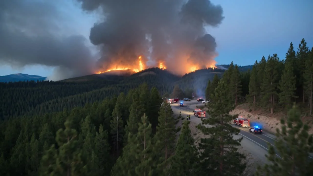
Fireground & wildfire awareness
Evaluate an elevated view of the incident area, access routes, surrounding exposures, and changing conditions. Select visual or thermal payload requirements around the information your command team needs.
First responders / Fire / Emergency management
Bring an aerial perspective to incident management. I help teams plan drone solutions through SAS and connect supported video feeds to command with SCOPE.
01 / Aerial awareness
Fire departments, first responders, and emergency management teams need information they can use. Start with the operational question, then build the aircraft and video workflow around it.
Evaluate an elevated view of the incident area, access routes, surrounding exposures, and changing conditions. Select visual or thermal payload requirements around the information your command team needs.
Explore aerial observation for defined search areas and difficult terrain. Match the aircraft, camera, operating conditions, and viewing workflow to your team’s search plan.
Plan aerial views of storm damage, flooded areas, road access, or affected infrastructure to support assessment and resource discussions as conditions change.
Evaluate sharing a supported drone feed with incident command, an emergency operations center, or designated partner teams. Give each viewing location a defined source, network path, and access plan.
These are use cases to evaluate for your team. Aircraft selection, payload capability, and deployment conditions are confirmed for the proposed solution.
02 / From the scene to the team
SCOPE provides the live video distribution step. Together, we can plan how a supported drone feed reaches incident command, an emergency operations center, and designated viewers.
Identify the aircraft, camera, and available video output.
Plan the video handoff, any encoder, and the uplink.
Receive a supported IP feed and redistribute it.
Test the receiving systems at each intended location.
03 / Your direct point of contact
I’m Chris Wright. I bring your operational, technical, and procurement questions into one conversation with SAS.
Whether your team is starting a drone program or connecting an existing platform, I can help define the equipment and integration requirement and coordinate the next steps.
Tell me what your team needs to see →Tell me what your team needs to see, who needs the view, and where you operate. We can start with your existing drone program or a new equipment requirement.
I coordinate the SAS conversation around aircraft, payloads, SCOPE, field connectivity, power, displays, and integration. We identify what you already have and what the proposed workflow needs.
SAS reviews the proposed source, network, and receiving systems. Define a demonstration or acceptance test for video quality, delay, coverage, viewer access, and behavior when connectivity drops.
I help organize the requirement for an SAS quote covering the agreed equipment, integration, training, delivery, and support. Products, availability, responsibilities, and terms are confirmed in writing.
04 / Plan the complete system
The aircraft is one part of the requirement. Bring the equipment and systems you already use so the proposed solution fits your team.
Define the operating environment, camera or thermal needs, endurance requirements, field power, training, and procurement constraints.
Drone & unmanned-system procurement →Identify uplink requirements, site coverage, mobile equipment, and the network path between the scene and each viewing location.
Network & communications planning →Define displays, source interfaces, power, packaging, acceptance checks, and who supports each part of the proposed system.
SAS systems integration →05 / Common questions
A drone can provide an elevated visual perspective for incident assessment, search support, and changing site conditions. The useful capability depends on the aircraft, payload, environment, qualified operators, and how the information reaches the response team. Chris helps define those requirements for a proposed SAS solution.
Potentially. SCOPE receives supported live IP video and redistributes it to downstream viewers or systems. SAS must validate your drone’s video output, any encoder or adapter, the network path, and the receiving systems before confirming compatibility. An existing drone can be part of the evaluation.
SCOPE supports the live video distribution step. It does not replace your incident command process or provide a complete CAD, GIS, flight-control, recording, or evidence-management platform. Any connection to another application, and any recording or retention requirement, needs its own defined scope.
Connectivity needs to be designed and tested for the operating area. SAS can evaluate the field network and backhaul requirement, including appropriate wireless or private-network options. A live feed still needs a working path to its viewers; coverage, available uplink, congestion, and interruption behavior are part of the evaluation.
Chris Wright is your direct point of contact and coordinates discovery, sales, and engineering through Superior Access Solutions, Inc. SAS quotes and delivers the scope it accepts. Flight operations, operating authority, and agency policies remain with the responsible organization and qualified personnel.
Yes. Chris is based in Coatesville, Chester County, and welcomes inquiries from fire departments, first responders, and emergency management teams across Pennsylvania, New Jersey, Delaware, and New York. Discovery can begin remotely; onsite work, travel, and availability are confirmed for each project.
Local service area
Chris is based in Coatesville and welcomes inquiries from Exton, Downingtown, and communities throughout Chester County.
Chester County services & town coverage →Chris helps fire departments, first responders, and emergency management organizations in Chester County frame drone, communications, and video requirements through SAS. A supported SCOPE video workflow can be evaluated for your command team and emergency operations center.
Describe your response mission, current aircraft and camera if known, intended viewing locations, connectivity, and purchasing timeline.
Discovery can begin remotely. Onsite meetings, installation, travel, and availability are confirmed for your project. Support also extends across Pennsylvania, New York, New Jersey, and Delaware.
Start with your mission
Share your response use case, existing equipment, and who needs the live view. I’ll help frame the next conversation through SAS.
Use the drone procurement planning guide →A useful first conversation
Share enough context to make the next conversation useful. You can also call (952) 312 9317 or email [email protected].
Product reference: Superior Access Solutions product catalog.